Monday, November 12, 2001
Starting My Fifth Month!
Hello from Crescent City, California!
Start time: 0730
Start odometer: 24924
Weather: Some heavy rain
overnight, lingering through the remainder of the morning. Temperature
56 degrees F.
I was greeted by a very wet
morning. The people here are very happy about this as it has been very dry
and they can use the rain. Winds were also present which made the coast
more dramatic. After touring the coast and the redwoods, I decided to take
the two hour trip to Cape Blanco in Oregon, which is the second most-western point
of
the continental United States. Had to keep up with my "most" motif!
After the visit, my drive south brought me back to Crescent City as night was
approaching, so I stopped here again.
(Added 01/02/03 - Thanks to
a knowledgeable visitor to this page, I have a correction as to the location of
the
western-most point of the continental United States. The actual point
is Cape Alava, Washington.
Cape Blanco is approximately .168 degrees Lon., or 7.64 miles east of Cape
Alava. My thanks to Kal from San Diego for this information.)
I started this morning watching
television to catch up on news, then drove to the Redwoods National Park Visitor
Center. After retrieving information and touring ideas, I headed first to
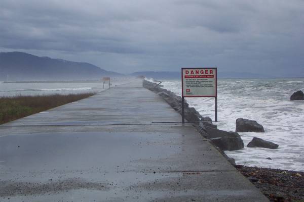
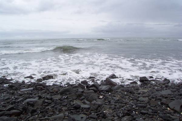
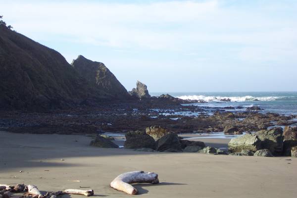
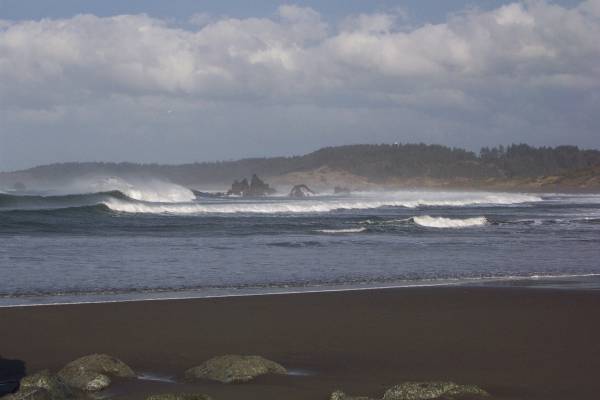
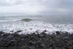
the coast to west of Crescent City. Some incredible sprays of water
were in the air as waves crashed against the breaker. It was raining on
and off, and somewhat added to the ambiance.
Click on picture for larger image,
hit back button to return to this page.
|
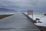
The break wall for the Crescent
City harbor.
|
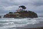
Battery Point lighthouse.
|
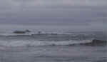
Six miles out (and barely
visible) is the Point St. George Lighthouse.
|
|
I called my sister in
Connecticut so she was able to hear the waves crashing.
|
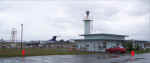
CEC - Crescent City Airport
|
|
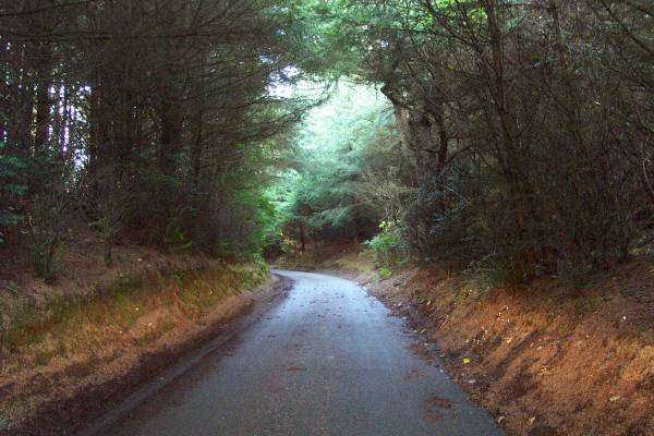
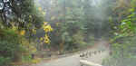
I returned to Route 101, then after passing through
the Crescent City, headed east towards a gravel road that would lead me to the Stout
Memorial Grove. This is the location of the first-ever protected grove of
redwoods. A short loop trail was available, and walking amongst these
giant trees was exhilarating! And the road through this area provided a
great view of the redwoods. Another must-do road for visitors.
|
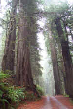
The single lane road through the
redwoods.
|
Bridge along the road to Stout
Memorial Grove.
|
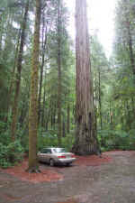
Parked at a trailhead.
|
|
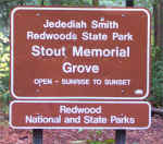
Sign for the first protected
redwoods.
|
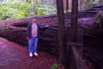
Massive trunks were strewn around
the forest floor.
|
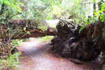
The base of a fallen redwood.
|
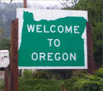
Before my departure from the motel this morning, I
asked the owner about the most western point of the U. S. and was told Cape
Blanco in Oregon had a lighthouse positioned there. Since it was only two
hours away, I took the drive after exiting the road through the redwoods.
I traveled north on Route 101 along the coast of Oregon and had some great
views! This is a very picturesque drive!
I arrived at the road to the lighthouse just after
1400, and a short distance from building itself the road was gated and
closed. I stopped at a parking area by the gate, and walk along the road
to the lighthouse. While it was peaceful since no one was around, it was
very noisy due to the wind! Gusts appeared to be greater than fifty mph, and
I was
pushed around a bit. Also, electric lines located along the
top of the hill made loud noises due to the strong wind.
After walking the field surrounding the lighthouse
and going as far west as possible. I returned to the parking area, then
took a trail to the beach on the north side of the cape. This was followed
by a drive to the campground nearby, and to the beach on the south side.
|
Back to Oregon for a few hours.
|
The gated road to the Cape
Blanco.
|
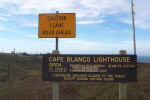
Entrance sign to the lighthouse
site.
|
|
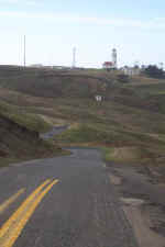
The road I walked to the
lighthouse.
|
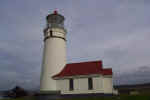
The lighthouse from the west.
|
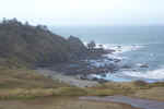
Looking north from the Cape.
|
|
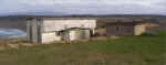
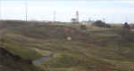
The building on the right is the
visitor greeting and tour center. I do not know the purpose for the
building on the left.
|
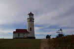
One more view of the lighthouse.
|
Looking south from the Cape.
|
|
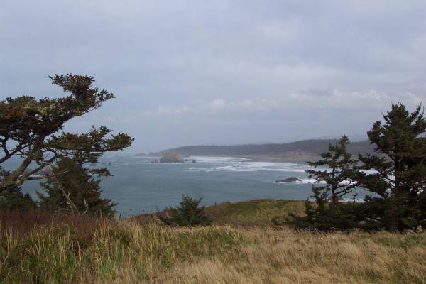
Looking towards the westernmost
point of Cape Blanco.
|
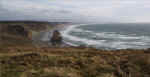
A trail to the coast on the north
side of the Cape is available, leading to this beautiful area,
|
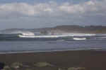
From the beach on the north Cape,
the wind blowing against the incoming waves helps to create a striking
scene.
|
|
After hiking up the trail,
looking back down onto the beach. Three people can be seen walking
near the bottom center of the picture
|
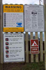
Many warning signs were posted at the
entrance to the lighthouse and coast trails.
|

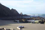
The road to a beach south of the
Cape.
|
|
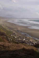
Another beautiful Oregon beach.
|
|
|
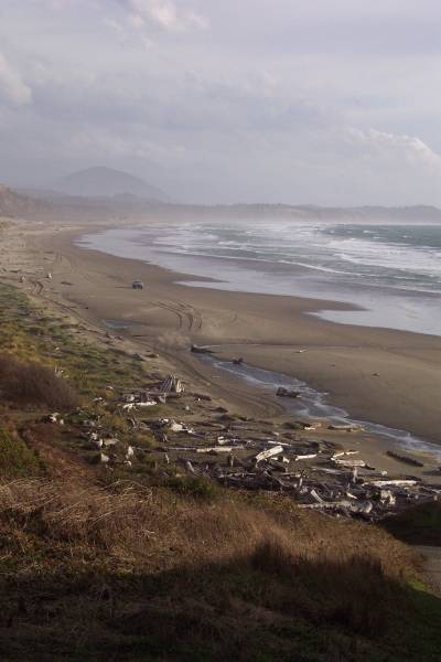
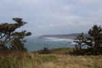
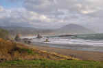
Heading south on US 101, I stopped at an overlook in
Port Orford. I then continued south and returned to California.
|
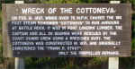
This was at the overlook in Port
Orford.
|
Part pf the ship described in the
previous picture.
|
The view of the coast from the
Port Orford rest area.
|
|
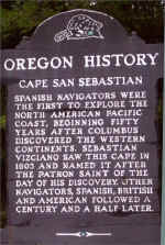
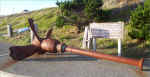
A historical marker along Highway
101.
|
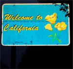
Back in California!
|
|
I plan to head in a southerly direction tomorrow, and see some of the
Redwoods National and State Parks. Thank you for stopping by!
Routes traveled today: US 101 - Crescent City Streets - County Road D2
- US 199 - Oregon 197 - US 101 - CR 160 - US 101
Lodging: Pennysaver Inn -
This page
accessed  times.
Page
created by: igorn@igorn.com
Copyright
© 2001 Igor N. Nikishin
All
Rights Reserved
Pictures
may be used with permission.