Sunday, January 23, 2000
This evening, I am in Pueblo, Colorado.
After a delayed start, I had a very nice drive and got to experience a wide
variety of environments. I stopped for the night in Pueblo as the sun was
setting, and it was a good place to position myself for a planned visit
tomorrow. I want to see Bent's Old Fort, a National Park exhibit
east of La Junta, Colorado. But more on that tomorrow.
This morning, I was packing the car before sunrise. It was eleven
degrees and it had snowed a bit overnight. I was a little cold, but ready
to get going when I noticed my front right tire was flat! Well, I hoped it
was just very low because of the cold, so I drove very slowly to a filling
station across the street. Unfortunately the tire separated from the rim
so the tire would not inflate. I called AAA and within thirty minutes a
tow tuck from H & H Towing Svc & Auto Repair arrived. The owner of the repair shop and towing company, Navid,
took the car to his shop and found a pinhole. He said I could have had it
for a few days, and that the cold temperature increased the speed of the
leak. Luckily, he was able to patch it and I was on my way, only a couple
hours after sunrise. I was glad that I was able to work with another great
mechanic! As I sat in his office, I looked at the numerous pictures he had
on the wall. These were photographs of many of the vehicles he has
retrieved off the side of the road that slid or lost control due to snow or mistakes.
I was amazed at how people lived through their accidents when looking at the
result of their misfortune.
I drove east on Route 50, and the weather was cool but the sun was shining
bright. I noticed clouds in the mountains, and knew I had to go that
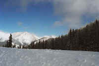
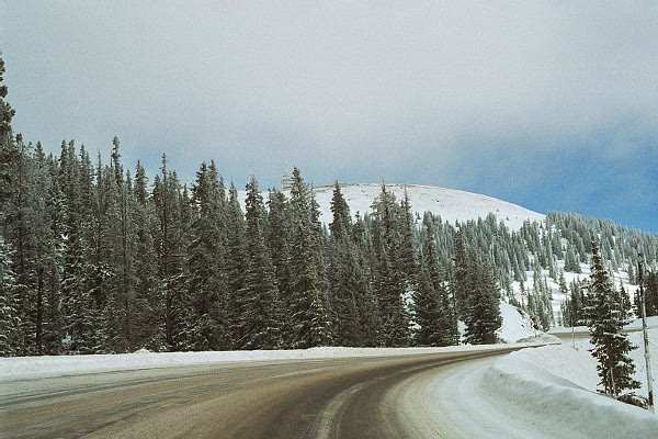
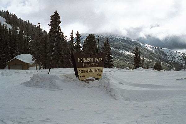
direction. The drive lead me to Monarch Pass, the location of the Continental
Divide. At an altitude of 11,312, I had some snow and ice to deal
with. It was also very cold and windy at the top. However, with all
these elements in play, there were extended periods of blue skies above, which
made for a fantastic setting. Of course, as long as I was in the car it
was great. I walked around a bit, at which point the beauty was
overshadowed by the cold and snow. I was not quite properly dressed, so I
went back to the car! I know I will need to get more warm clothes in the
near future!
I continued east on Route 50, and as expected, the further downhill I drove,
the dryer and warmer it got. I turned off the heater by the time I reached
Salida, which used to be a riverfront railroad town, now turning to
tourism. They have a historic downtown district that I drove through with
many old buildings being refurbished and used towards the new town direction of
sightseeing.
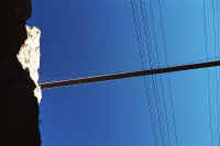
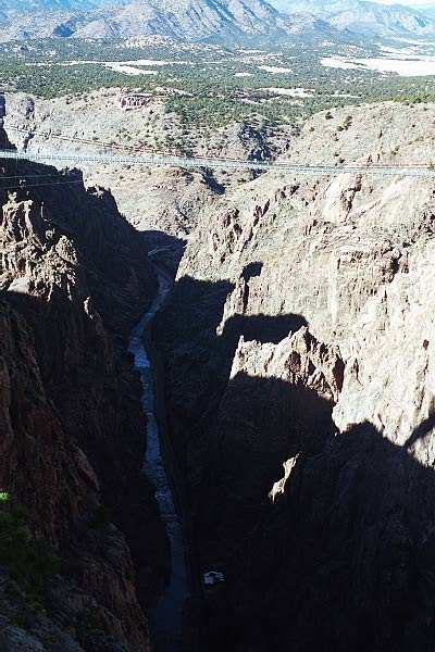
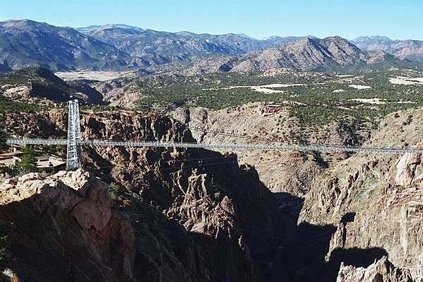
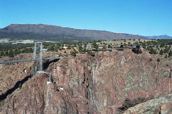
My next stop on Route 50 was Royal Gorge outside of
Canon City, Colorado. The claim to fame for Royal Gorge is the
highest suspension
bridge in the world. They also have the steepest incline railroad in the
world. Conversely, driving to the place you see some of the tackiest
tourist traps in the world! ;-) Avoiding those areas, the setting is
nice and there are some nice views.
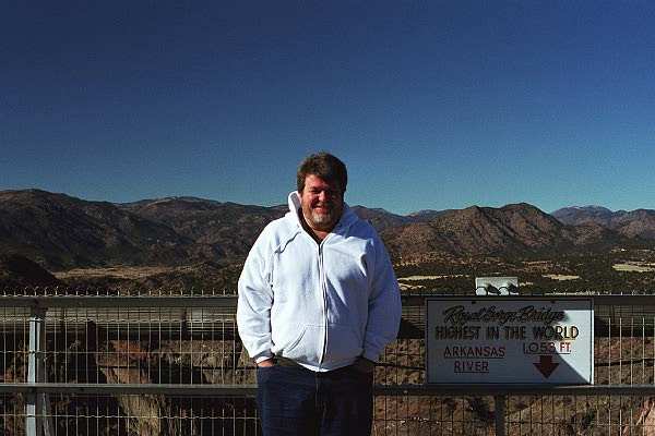
The bridge is 1,053 feet above the Arkansas River and you can walk and drive
over the wooden planks that cross between the suspended supports. It is an
impressive walk and looking down at the river is ominous. It was a little
windy today, which combined with the cars driving on the bridge made for an
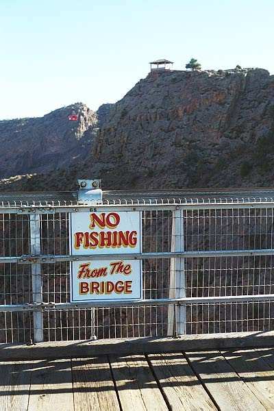
interesting walk. As for humor, they have a sign at the midpoint of the
span which reads "No fishing from the bridge." After walking
back across the bridge, I went down the incline railroad. It is an
interesting journey as you stand in the specially constructed caged cars slowly
dropping towards the river. Exploring the area near the river one can see
the engineering feat of the railroad that was built through the gorge beside the
river. At one point near the drop off area, a "hanging bridge"
was used to support the railroad tracks as the gorge was not wide enough to
support other designs. The hanging bridge is basically two supports that
cross the river above the tracks, with supports that hold the track up above the
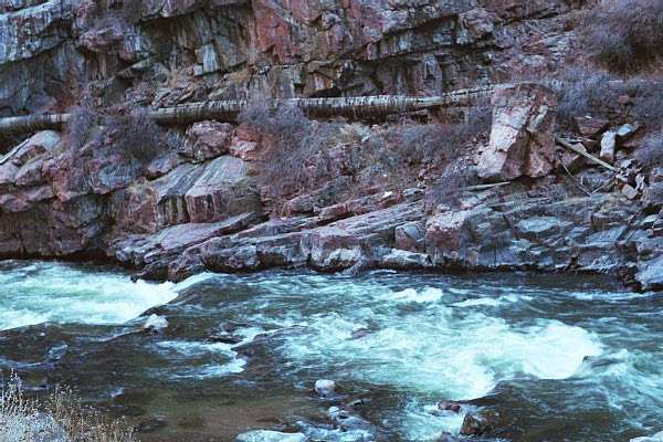
water. Not sure if that description works... Also, along the other side of
the river are the remnants of a thirty inch diameter wooden pipe running along
side the river that was used to transport water to Canon City years ago. I
returned to the top of the incline and yes, I drove over the bridge! And
the car made it without any problems!!! ;-)
I returned to Route 50 and just west on Canon City, I turned onto the Skyline
Drive, a three mile, one-way drive across the top of an 800 foot hill.
(Description from Road Trip, USA.) When they say the top of the hill,
they mean it! The road follows along the crest of a ridge, with nothing
but drop offs on either side! But the views are incredible!
Canon City is also the location of Colorado's newest maximum security prison,
with some well known inhabitants, such as Kaczynski,
Yousef, and McVeigh.
I did
not stay around to see if they had a tour! Just east of town I noticed a
sign near a farm that read "Colon Orchards." I decided not to
tour that place either!!!
Finally, I found a hotel in Pueblo Colorado, and should be in Kansas tomorrow
night.
Routes traveled today: 50 - Royal George Road - 50 - Skyline Drive - 50
Again, thank you for paying a visit to the page. Until tomorrow....Igor
Hotel: Motel
6, Pueblo Colorado
Gas: None
Click on picture to get enlarged
view:
|
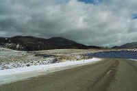
The view west of Ginnison,
looking at the Rocky Mountains.
|
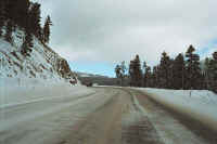
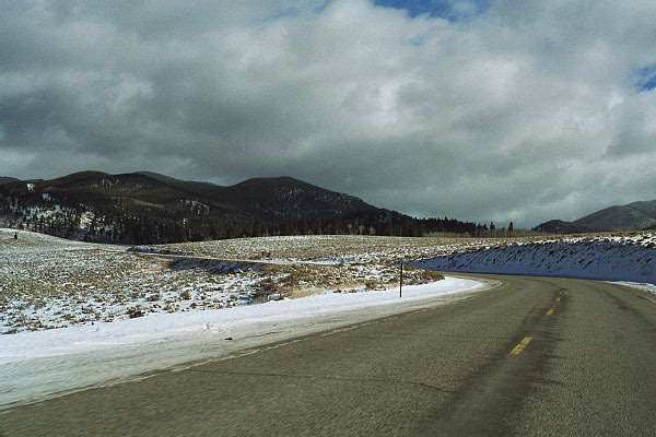
Route 50 towards Monarch Pass.
|

I was glad the road was open and passable!
|
|

At an altitude of 11,372 feet, this was the highest elevation on the trip,
and I would never get near this altitude on this drive again!
|
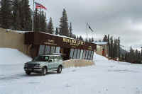
A gift shop and ticket office for a tram up the mountain.
|
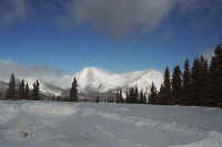
Beautiful snow everywhere!
|
|

I decided to have lunch while I was parked. A ski area is visible
beyond my car.
|
My final picture at Monarch, as I continue my journey east.
|

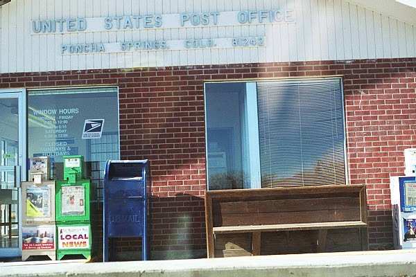
Poncha Springs Post Office...One of many mailboxes used during the trip.
|
|
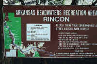
Descriptive tablet about the Arkansas river, which I would follow for some
distance.
|

Information on the rapids along the Arkansas.
|

A view of the Arkansas River.
|
|

Tourist Time!
|

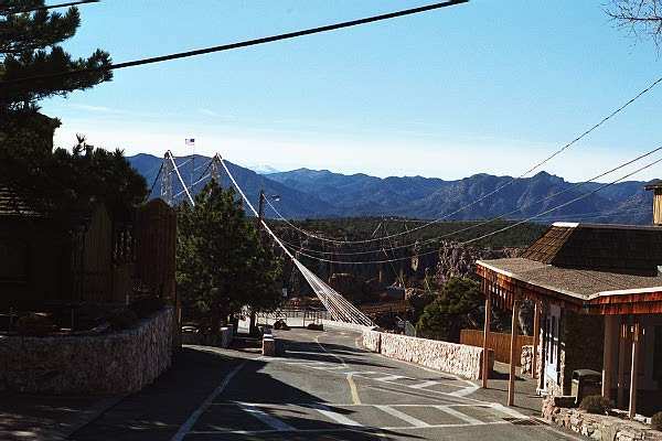
The North approach to the
bridge.
|

Royal Gorge, looking
northwest.
|
|
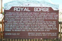
Information from the State
Historical Society of Colorado.
|

Walking along the bridge,
avoiding the cars.
|

A plaque from when the bridge
was originally constructed.
|
|
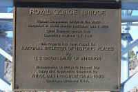
National Register of Historic
Places plaque.
|

I had to pose at the highest
point above the river!
|

A cute sign at the center of
the bridge!
|
|
These next five shots are from a trail up to the pavilion located near the
top of the previous picture.
|

Looking northwest.
|

Beautiful scenery surrounds the site.
|
|

This is a view looking southeast from the pavilion. The cables are
for a tram that crosses the gorge.
|

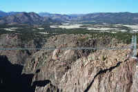
Looking north towards the Royal
Gorge complex. On the other side is an inclined railway, which
carries visitors to the river.
|
Looking up at the bridge from the river.
|
|

The river, with a wooden pipe that was used to transport water to a local
village seen in the background.
|
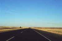
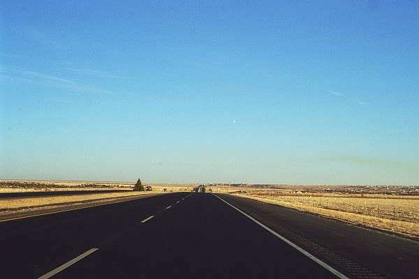
As the day draws to a close, I travel east to Pueblo.
|
|
This page
accessed  times since January
1, 2001.
times since January
1, 2001.
Page
created by: igorn@igorn.com
Copyright
© 2001 Igor N. Nikishin
All
Rights Reserved
Pictures
may be used with permission.


