Wednesday, January 12, 2000
Hello from Ely, Nevada.
I had a very eventful day! I made it as far as Ely, Nevada (pronounced
E-Lee, as in Robert E. Lee) which is near the Utah border on Route 50.
Sunrise is at 6:58am, so I am planning for an early departure. Also, I
will be changing time zones tomorrow.
After participating in the continental breakfast provided by the Best Western
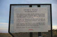
in Fallon, I headed east on Route 50. About ten miles outside of town is
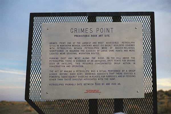
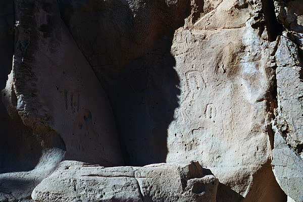
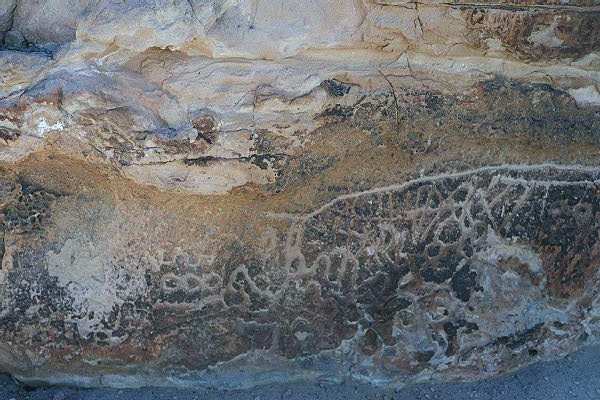
an area called Grimes Point
(360
degree panoramic view) (another
Grimes Point site) which contains a grouping of petroglyphs. I
took a self guiding trail that passed by hundreds of images etched into the
rocks. Across the highway is the Fallon Naval Air
Station, home of the Top Gun
school. I was able to watch several pairs of what appeared to be
F-18s take off.
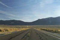
I continued east on Route 50 and over the next few hours,
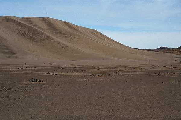
stopped at Sand Mountain,
a very large sand dune that sometimes resonates (it was quiet while I was
there.) I also passed by a bordello.
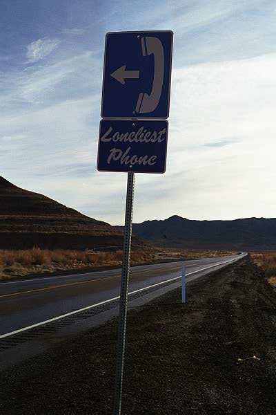
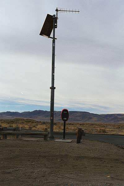
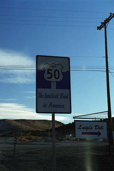
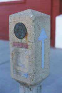
As for a tourist thing, I called my sister from the
"Loneliest Phone." To explain...Route 50 is nicknamed "The
Loneliest Road" since most people take Interstate 80 across the west and
Route 50 is quiet. Nevada plays up this title in several ways including
sign posts, stamped Route 50 passports, referring to things as being the
loneliest, including the telephone I used this morning. It sits on the
side of the road with nothing around, is solar powered, and is connected to the
phone system by antenna, as no wires are around! As for the name
"Loneliest
Road," I understand, as there were many times that I
saw no cars for many miles.
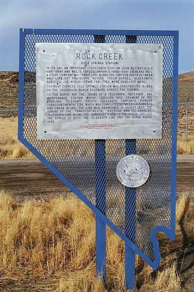
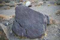
There is a lot of history along this road, and I stopped by many roadside
displays located at Pony Express stations, old towns, and mining
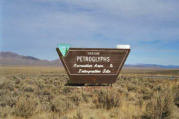
locations. Further down the road, I turned onto a gravel road to drive to
the Hickison Petroglyphs Recreation
Area. I drove slowly down the road as it was a bit
rough, but then suddenly, I came across an intense washboard section. The
car bounced around as I continued to slow down, and then it stalled. I
attempted to restart the car, but it would not run. Ouch, I thought, as I
looked back for a half mile towards the "Loneliest Road!" I had
my ham radio two meter rig and my cel phone, and at worst, I could hike up one
of the hills there to try to communicate. However, as I looked under the
hood, I noticed my coil cable had come off and one spark plug cable came off the
distributor cap. Very nice that this was the only problem! After
putting things in their place, I continued down road and did a little hiking.
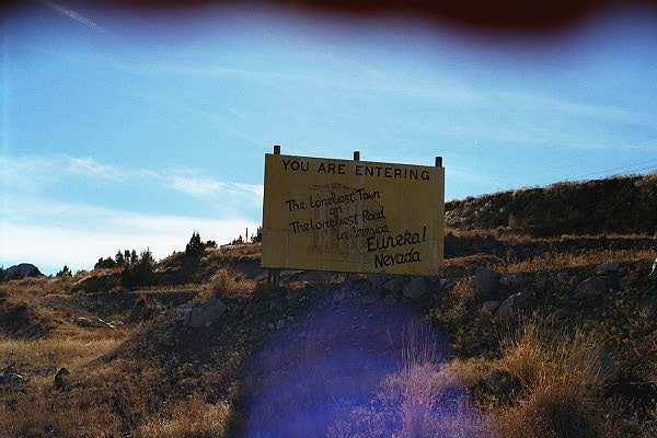
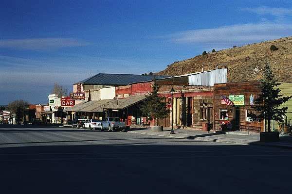
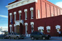
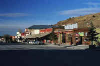
My next stop was in the town of Eureka,
Nevada. This town had many
mining sites nearby, and around 1880, there were up to 10,000 inhabitants.
Today, there are approximately 600. The local industry is still mining,
and the most productive gold mine in the country is here.
I visited the Eureka Museum and met a wonderful lady and we spoke of the
town. She had much information, as she has lived in the area her whole
life. She has relatives that live in other parts of the country that
continually ask her to move, but she does not want to leave. She told a
story of her own family, about her son Cory, getting hit by a car and almost
losing his life, and how the community got together to help with the recovery
and finances to assist him. I got to meet her son Cory while I was there.
Quite a recovery, and he is winning the battle. She also mentioned that if
I happened to stay in town for the night, not to be startled at 9:00pm when a
siren goes off. It is the curfew alarm, and all children under age
18 are to be off the streets! Everybody agrees to it, and respects
it! Thank you for the great conversation, Narline.
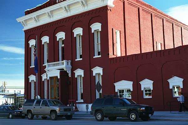
Eureka has a walking tour that I took with a provided flyer in hand. My
favorite building was the courthouse, built in the late 1800s. One of the
staff saw me walking around and directed me upstairs to the main
courtroom. She said the light switches were behind the door to right, and
to make sure I turned them on as it would help view the room. Quite an
incredible room!
Here are three links to panoramic
views of Eureka:
Eureka
Opera House
Eureka
Sentinel Museum
Eureka
County Courthouse (Link may be bad)
Finally, I continued east on Route 50 and stopped in Ely
to stay for the
night. I had dinner in the Hotel
Nevada Casino restaurant. I am still not used to
sharing the dining room with smokers! ;-)
Route traveled today: 50
It was a very educational drive today...Thanks for reading the page...Igor
Hotel: Bristlecone
Motel, Ely
Gas: $1.76
Click on picture to get enlarged
view:
|
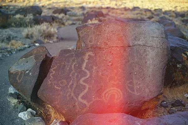
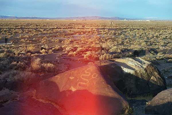
At the Grimes Point petroglyph site.
|
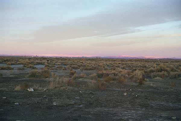
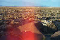
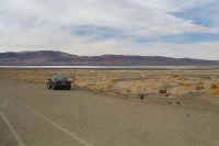
A view west towards the Fallon Navel Air Station and Fallon, with
beautiful sun rays on the mountains in the distance.
|
Petroglyphs
|
|

The next three pictures were damaged when I had to open my camera to
free the film jam.
|
The petroglyphs were very interesting, so I wanted to include these
pictures.
|
Amazing rock indentations!
|
|
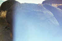
Sand Mountain approach looking northeast
|
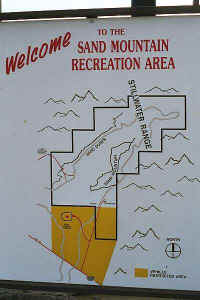
Entrance sign
|
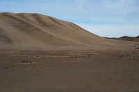
Beautiful sand mountains
|
|
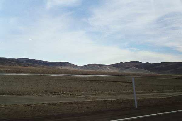
Sand Mountain access road looking southeast at an interesting
sky. Much four wheel driving in the area.
|
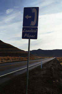
The sign!
|
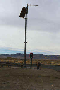
This is it! It will probably not make it on any top ten tourist
lists!
|
|

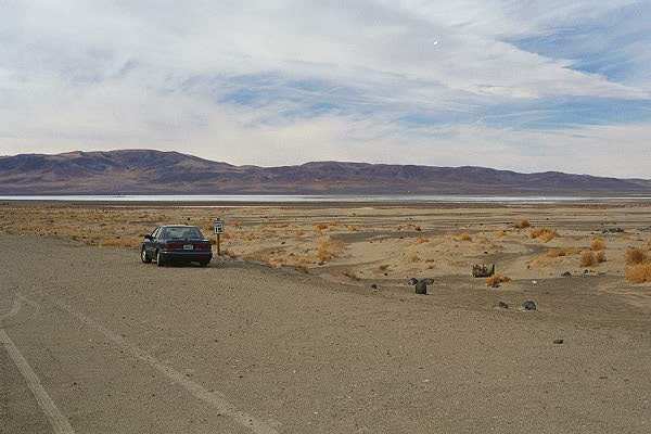
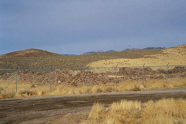
Stage coach and Pony Express station.
|
Walls still visible at the station.
|
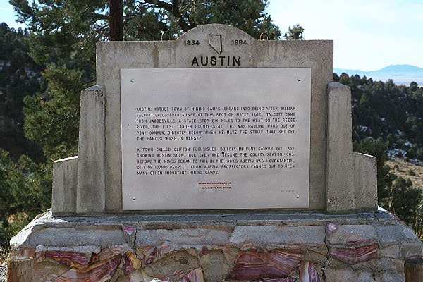
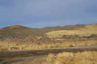
Austin, Nevada, an old mining town, with people very interested in Burning
Man, including a regional burn!
|
|

The view opposite the Austin sign, looking west. I was
constantly surrounded with incredible long distance views!
|

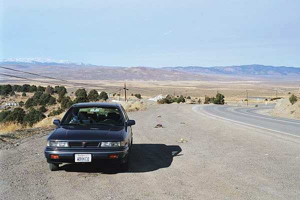
Entrance to the Hickison Petroglyphs Recreation
Area, where I stalled
the car. Not much civilization around!
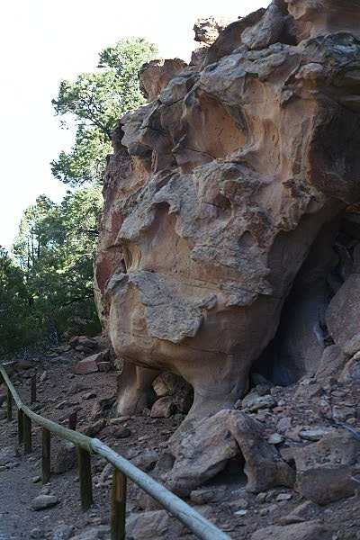
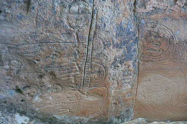
|

Trail through the area, along rock faces with ancient petroglyphs.
|
|
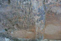
More interesting petroglyphs!
|

Another set of petroglyphs
|
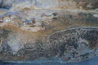
Amazing artwork!
|
|
Entrance sign to Eureka, Nevada, with the "Lonliest"
theme!
|
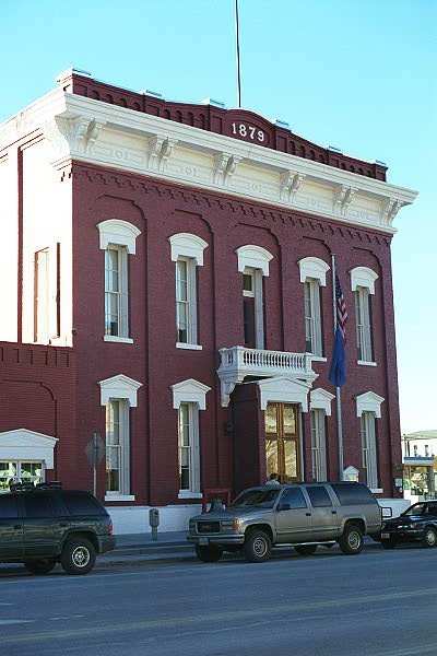
The Eureka Courthouse, looking southeast.
|

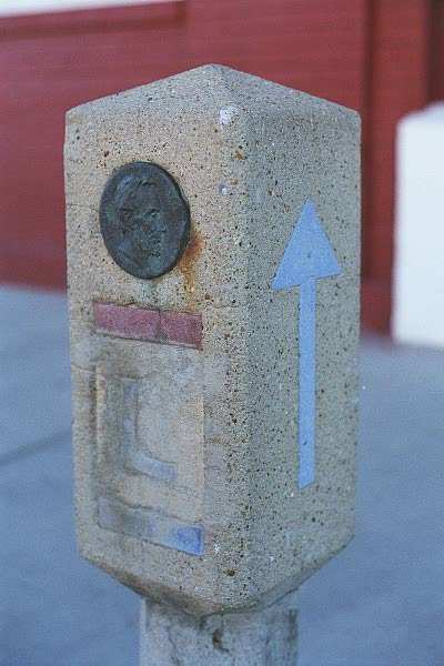
The Courthouse, looking Southwest. Between the two trucks is the
Lincoln Highway marker pictured below.
|
|
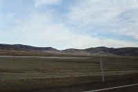
Looking west along route 50.
|
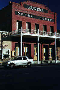
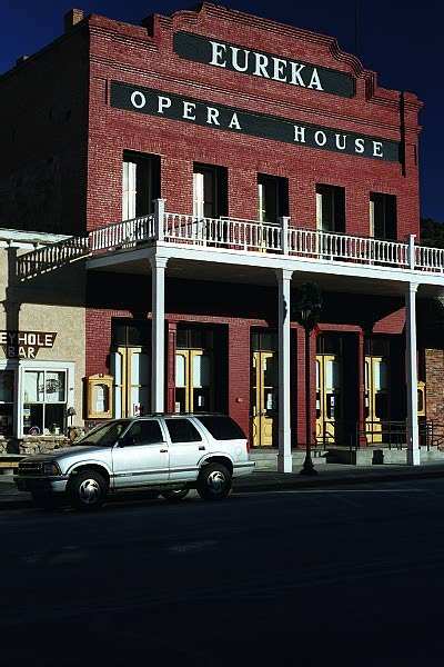
The Eureka Opera House, where many shows were performed, as depicted in
westerns!
|
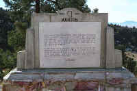
The Lincoln Highway marker.
|
|

Heading east on route 50 out of Eureka, past Luigi's. Sorry, I
did not get a chance to eat there!
|

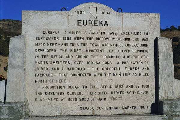
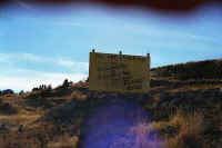
Nevada historical marker for Eureka.
|

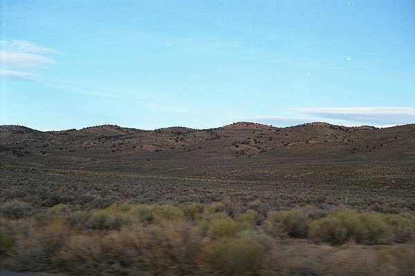
A view from the car.
|
|
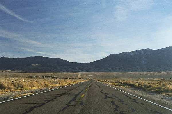
Along route 50, and yes. I will be travelling on the pass you see
ahead!
|

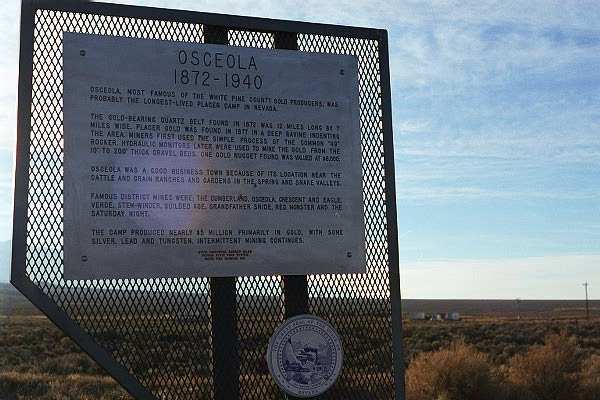
Another historical marker for a mining town. Many interesting
stories can be read along the road.
|
|
This page
accessed  times since January
1, 2001.
times since January
1, 2001.
Page
created by: igorn@igorn.com
Copyright
© 2001 Igor N. Nikishin
All
Rights Reserved
Pictures
may be used with permission.